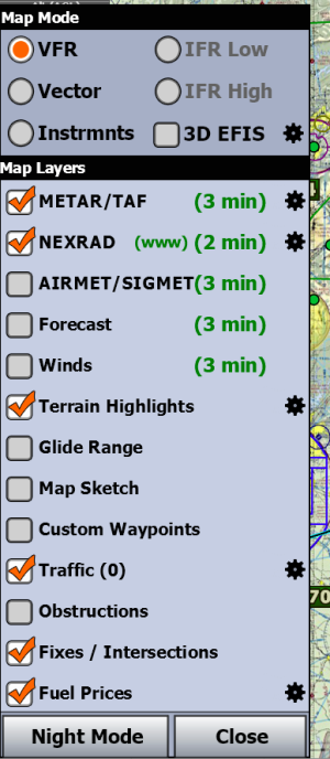
When I bring up iFly EFB the TAC and/or WAC charts don't populate when I open the app. I have looked all over the program for a fix of some kind. to no avail. When I look under Chart Expirations it shows that the TAC and WAC charts are installed.. The screen sort of looks like it's digital data, Shows state outlines, with airport circles or airport areas and weather dots categories BUT NO radar, hills/mountains, obstacles, roads, or pretty much anything you would like to see on a VFR TAC/WAC chart. I can tap on the airport circles and get the weather and everything else including warning areas, MOAs, It will show extended runways also. Help please, thanks, Paul
You are using an out of date browser. It may not display this or other websites correctly.
You should upgrade or use an alternative browser.
You should upgrade or use an alternative browser.
After updating to iFLY Version 13.2.23 this morning "I have a problem Houston", November 7th.
- Thread starter WXMAN
- Start date
- Joined
- Apr 13, 2023
- Messages
- 1,286
- Reaction score
- 313
Welcome! When asking questions, please help us help you.
Specifically, your device type, operating system version, and screenshots or video of the behavior you're seeing could be helpful.
Specifically, your device type, operating system version, and screenshots or video of the behavior you're seeing could be helpful.
Hey Roger E.,Have you tried zooming in? If I understand your question correctly, that will change the type of map you will see.
Zooming in made no difference. It did get me to the closeup of the airport with immediate terrain around and on the airport and when zooming out it got rid of anything looking like a map. It is simply a screen with no normal map features, erased clean but still shows the airport dots with the weather category. I can change on Select Map from to and from WAC and TAC and either map has no features. I got up early this morning to drive my wife to a dental surgery appointment and drove 6 hours total and my battery is run down . All my Inst Group are displayed as I set them and are not affected by changing from WAC to TAC. In fact other settings seem unaffected by this map problem. I will address this tomorrow and get back to you. Thanks for your input. IPAD Mini 6, iPAD IOS 18.1 ,iFLY V. 13.2.23.
Hey Cobra,
I will send a screenshot tomorrow, thanks for your interest in my problem. I think the iFLY program got corrupted and tomorrow I will delete the iFLY App and redownload it. Since there were no reports of this problem on the site it's probably my IPAD issue. Cheers,
I will send a screenshot tomorrow, thanks for your interest in my problem. I think the iFLY program got corrupted and tomorrow I will delete the iFLY App and redownload it. Since there were no reports of this problem on the site it's probably my IPAD issue. Cheers,

