potatohead
Member
- Joined
- Apr 20, 2023
- Messages
- 15
- Reaction score
- 4
Could iFLY provide guidance on the map update frequency as it relates to each layer? I noticed a difference the other day when compared to the FAA sectionals, which I'll explain below. The difference got me wondering if there are different update cycles for different map layers?
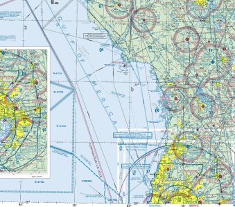
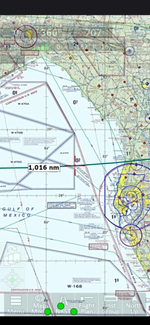
The difference that prompted this question is that iFLY shows "Gulf of Mexico" yet the FAA shows "Gulf of America". I had a FF holdout check his EFB and it shows "Gulf of America" as do https://www.1800wxbrief.com, https://www.iflightplanner.com, https://www.skyvector.com, and https://vfrmap.com.
The name for this body of water is not the issue. Please leave politics out of this thread. The issue is, shouldn't all our charts match?
I would imagine this is part of a base layer element and maybe it just doesn't get updated as often, but I'm curious what other chart data might be delayed?
Attached are screen shots from iFly V13.3.55, and FAA's Jacksonville sectional 19-Mar-2026.
Thanks