tbouchertx
Active member
- Joined
- May 28, 2023
- Messages
- 38
- Reaction score
- 9
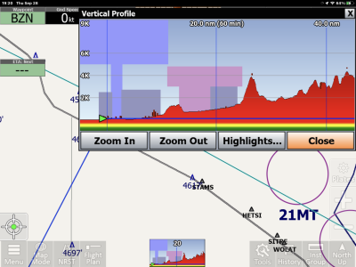
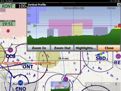
You can also click on one of the colored boxes in the altitude profile, and a pop-up will ask if you want to 'View on Map', then take you right to that point on the map where you can see it and access more info.Ok, so I think figured it out. I entered a flight plan from LAX to Ontario and ran it in simulation mode. I was able to see the different airspace, color codes and now understand how to read it. I suspect the yellow/tan areas on vertical profile are the TFRs.
You or someone else asked what the two horizontal lines across the top of Vertical Profile represent. I replied (somewhere) that I couldn't remember where the key was. Well, some of them are simple--in 13.2.37, at least: Tap on the Layers button at the bottom of the Vertical Profile pane. Those two lines are Flight Conditions and Surface Visibility.I am trying to figure out all of the color coding through altitudes on the vertical profile. User manual really has nothing. Any other place to reference? Could this be airspace? Thanks